Category: Exploring

Dive in to my adventures and travels of all kinds here. From outdoors to urban and via foor, auto, motorcycle, or as a full-time RVer, I’ve embraced adventures of all kinds.

  • April Escape: The Western Sierra

    April Escape: The Western Sierra

    I awoke reluctantly, submerged in pure white linens and the cushy softness of hotel pillows. I was wrapped in comfort. My eyes took in the dim light as my brain tried to recollect where I was. After five days on the road, disorientation began to set in each morning. You know the feeling—coming out of sleep bewildered by unfamiliar surroundings. Oh yes, I remember now. We stopped in Visalia last night but it wasn’t our goal. That’s how the day played out on this April Escape mini-trip, though.

    Still sluggish but gathering some coherence, I began to picture the day ahead. I was determined to get back to camping. The comfort and luxury of a hotel room is marvelous, of course, but that wasn’t what I set out for on this trip. I was fixated on the luxury of sleeping under the moonlight, immersed in the sounds and smells of the outdoors.

    That motivation drove me out of bed earlier than usual. I took advantage of the hotel suite to spread out and do some yoga before another muscle-stiffening day on two wheels. Over breakfast, I scoured my campground app for options. We would move towards the Groveland-ish area where there are several campgrounds that might work.


    Day 6

    april escape day 6 map - val in real life
    Day – Visalia, CA to Friant, CA

    Mileage: 115

    Route: CA 198, CA 216, CA 63, CA 180, CA 168, N Friant Rd, North Fork Rd/CA 206, CA 145

    Setting out:

    We set out from downtown Visalia, refreshed from showers and a good night’s sleep. We also set out thinking we knew Visalia’s roads better than we did. Riding back out the way we came in, we didn’t realize we’d missed our route north until we were way off course. There were moments of conversation between us in our headsets, as you can imagine. “Hmmm… shouldn’t we have made that turn by now?” and “This doesn’t seem quite right.” Clearly we weren’t as awake as we thought, since we continued on in the wrong direction.

    Eventually we stopped to regroup. Sure enough we were already way off. No matter. We embrace the surprise discoveries that unexpected detours can reveal. This case was no different. Looping back to catch our intended path, we rode through grove after grove of orange trees. The blossoms filled the air with their thick scent, so sweet it was nearly overwhelming. Bees filled the air as well, smacking into our arms and chests as we rode.

    Deciding on an end game for the day:

    It was an excellent ride but slow going with lots of farm equipment using the roads to move between the orange groves. The detour to get out of town cost us time. Getting to Groveland would be a stretch. And we didn’t need or want to push hard on this trip.

    By the time we descended from the foothills back into the valley we were tired. We’d been riding non-stop and needed a rest. We kept riding through to Clovis, looking for a one-stop solution for lunch, fuel, and camping rations. We eventually found it but not before getting wrapped up in aggressive Clovis traffic.

    Over lunch, we rethought our plans and found a new camping destination not far from Clovis. We pushed on to Millerton Lake State Recreation Area. I had managed our navigation for most of the day as fatigue beset my dear man. Now it was my turn to be cared for. I was cooked. Looping around and around the campground to find an agreeable hammock camping site was about to push me over the edge into full-on “fuck this” mode. We were tired and decisions became an ordeal. So he took the lead and stopped to chat with the campground host, Shirtless Steve.

    That worked out well. Steve pointed us to the sites best suited for our gear and protection from the evening winds. We chose a site from the few he recommended and it turned out to be one of the best campsites I’ve ever had. It overlooked the lake with trees ideal for hanging our hammocks right next to one another. And because it was the middle of the week in off-peak season, the campground was nearly empty. It was glorious.

    Problem-solving, MacGyver style

    Camp setup was fairly simple and we were soon only concerned with how to chill beer and wine in the cool lake water. The wave action precluded simply setting them at the water’s edge as they would quickly drift away. We needed to get creative with a bit of MacGuyvering. With my dear man’s Rok Straps and a hastily emptied Eagle Creek packing cube, I had my solution in short order. We would have passably chilled beverages with our dinner.

    For all of our foibles that day we ended having one of the best camping nights ever. I felt light and free. I set up my camera for a time lapse over the lake, something I haven’t done in ages. We embraced sleep nestled closely together in our hanging cradles. In all of our travels, this was our first night ever camping off the motorcycles together. And it was amazing.

    Cool stuff:

    Day 7

    april escape day 7 map - val in real life
    Day 7 – Friant, CA to Sonora, CA

    Mileage: 148

    Route: CA 145, Rd 211, CA 200, CA 41, CA 140, CA 120, CA 49

    Camp exit:

    We packed up camp slowly, taking in the scenery before we left and basking in the delight of our time at Millerton Lake. But it wasn’t long before we were under attack. Resident Columbia ground squirrels had their sights set on our food. And they were clever little boogers. They worked together, distracting us on one side of camp by initiating a chase while others snuck in from behind to boldly jump into our gear in pursuit of a yummy treasure. Even when we caught on, they circled, waiting for us to drop our guard so they could run their next gambit.

    It was exhausting and certainly evaporated our desire to linger. They were clearly better at this game than we were. I had a lengthy inner-rant about the campers who feed these animals and/or don’t keep their food secure. The squirrels are not at fault; they are simply going for the easy meal they’ve learned exists around humans.

    The internal rant faded as we finished packing and set out to ride again. I left with some sadness knowing this would be the last camping night of this trip. But Yosemite was ahead. We wouldn’t stay there but we would ride into the valley, have lunch, and soak in the majesty. Amidst the traffic, of course. You have to accept that if you want to visit a marquis-level national park.

    Bring on Sonora:

    Yosemite Valley was as stunning, as always. Then it was time to move on. One of the only plans we made on this trip was for our last night to be in Sonora. We wanted to revisit the fabulous Bourbon Barrel whiskey bar to cap off our adventure.

    We didn’t make a reservation at our favorite hotel, The Sonora Inn, until we arrived in town. That’s typical for us—a safety net in case we don’t get as far as we planned on any given day. The Sonora Inn is a wonderful historic hotel. And it has its quirks because of its historic nature. So when I called and was told the elevator was out of service, I was not only unsurprised, it was a non-issue. It’s not fun hauling all of our gear up stairs but not a deal breaker. The desk clerk asked if I wanted second or third floor. Under the circumstances, that answer was clear, “Second floor, please.”.

    Oh, silly Val! You forgot this isn’t a “normal” hotel. The Sonora Inn has wonky floor levels. We were assigned a room on an odd half-floor. We had to schlep our bags from the back parking lot to the front of the hotel, up the stairs, then to the back of the hotel, and back down the “half-level” of circular stairs to our room. It was a fucking expedition. Had I chosen the third floor, life would have been much less exhausting. Not fewer stairs, but less distance and easier going. Lesson learned for the next time in Sonora!

    Surprise in Sonora:

    The next issue? Fuck me if the Bourbon Barrel wasn’t closed for a construction project. It was one of our main reasons for returning to Sonora. But we’re flexible travelers, right? So we moved on in hopes of finding a new experience in Sonora. We found it at Emberz, thanks to an excellent bartender. As we often do, we enjoyed a leisurely tapas-style dinner at the bar.

    A couple of cocktails into the evening, a rather animated woman sat down next to us. We often chat with our bar-mates on the road but this one was more memorable than others. The evening transmuted into a counseling session about her boyfriend woes. Therapist Val was in order, it seemed. I hope I was helpful. She’s a nice lady, her situation unenviable and both parties have a lot of issues. We wandered out of the restaurant many hours later a bit shell shocked for the experience but all the more grateful for our healthy relationship.

    Cool stuff:

    Day 8

    april escape day 8 map - val in real life
    Day 8 – Sonora, CA to Dayton, NV

    Mileage: 161

    Route: CA 49, CA 88, Hwy 395, Hwy 50

    The road home:

    Day 8. Heading home. I’m somewhat notorious for saying home is a four letter word. That was before embracing my amazing life in Nevada with my dear man. While having a home base isn’t necessary for me, what I have now is an incredible sanctuary. Even so, re-entry is a task to be handled carefully. The ride today would be a mental exercise. To shift gears and embrace the next phase of travel. This trip was meant to be an antidote to that. And now it was ending.

    Our route on the final day was about getting home. What lay ahead was a familiar ride from Sonora to Dayton along CA 49 and US 88. Familiar doesn’t mean boring, though. After the biggest breakfast in human history at Riderz in Sonora, we set out.

    Highway 88 is the southernmost trans-Sierra highway that the state keeps open year round. And even though it was late April, snowbanks clung to the hillside along the route. A reminder that I was far from my lifelong stomping grounds in the southeast.

    We rode. Sometimes silent. Sometimes marveling at the sights together by talking through our headsets. There’s always a somberness to the end of a journey, though. Wondering what would happen if you just kept riding, responsibility be damned. We went home, of course, collected the adventure dog from the sitter and returned to our daily life.

    Cool stuff:
    • Riderz Family Restaurant, Sonora. Super nice folks running this little restaurant connected to the Sonora Inn. More food than is humanly possible to eat in one sitting.
    • Carson Pass. This is a fabulous ride peaking at 8,652 feet. Stop and enjoy the view. It’s worth it.
    • Caples Lake. It’s glorious when the lake comes into view along Highway 88. Take the time to stop and marvel.
    • Mad Dog Cafe, Woodfords Station. This little cafe is spitting distance from home and a frequent stop for us on a day ride over Monitor Pass. Stop, grab great food, take your chance on a lottery ticket.

    Thanks for following along on the April Escape series! I hope you found out about some places you’d like to visit. Like I said early on, this trip was about refreshing some of my stagnant travel routines and skills.

    I only ended up with two nights of camping which is slightly disappointing. It’s ok, though. I have enough information now to know what I need to refine in my setup. More importantly, I have renewed confidence about getting out on the bike this way. More thoughts on that to come. Stay tuned.


    The full ride map


  • Expand Your World With Local Travel

    Expand Your World With Local Travel

    A few weeks ago, my pal John Cloonan wrote a nice post about travel. It wasn’t about far-flung, exotic adventures but the value of what can be discovered nearer to home. I was shocked to learn his young colleagues didn’t know what lay outside of their small urban-Atlanta bubble.

    International travel has its benefits and thrills, no doubt about that. As a blogger in the adventure travel niche I spend a lot of time in contact with travelers who have lived as nomads, overlanded around the world, and have had “epic” adventures by today’s social-media standards. However, what I do is small beans compared to all that. Being a small fish in a big pond doesn’t bother me, though. I do what I can, when I can, and on my terms. That’s all any of us can do, right?

    The point is, I’m doing it. And it doesn’t take epic, travel-magazine worthy adventures to bust you out of your silo. Just embracing the unfamiliar is enough. And more diversity exists within a half-day’s drive of wherever you are than you might imagine. If you open your eyes. Leave judgment and expectation at home. Explore.

    It’s why I continue to explore the intricacies of the area surrounding my home base. It’s accessible in short stints and on short notice. Oftentimes, I can travel inexpensively. It ties me to this area that is my home in a bigger way because I can dig deeper. I always find something new and surprising in every direction.

    Get out there

    You know I’m not going to simply wave the travel banner and send you on your way if you’ve followed me for any length of time. I’m going to give you a kick in the ass as I shove you out the door. You live in a world of incredible technology. Use it. If just wandering out of the door with no idea where you’re going isn’t your style, find one of the gazillion apps that can help you pick a destination. If that’s a roadside guide that takes you to the world’s biggest ball of twine and you find other cool stuff along the way, so be it.

    Try geocaching, go catch Pokemon, seek out a festival in a small town—whatever it takes to excite you and give you a goal. Just get out the fucking door somewhere beyond your daily bubble. Do something new. Go someplace new. One of my favorite new rules of thumb is the 50 miles rule. It’s brilliant. You’ll be surprised how many times you say to yourself “I had no idea this was here!” once you get out there and open your eyes.

    Step out of the pre-conceived notions that broadening your life experience can only happen in seductive far-flung locales. Resist the illusion that you’ve experienced something or know what a place is about because you’ve seen Instagrams about it. Stop making excuses. Pushing the edges of your comfort zone, even little by little, has tremendous value. There are cool places within reach on a weekend. Adventure is out your back door.

    Building a better world

    Sometimes what you see will be dismaying. Most of the time it’s delightful. It’s always educational. You’ll notice the differences from what you’re familiar with. Above all, you’ll also notice how much is the same about the basic human condition. That’s what creates understanding and kindness in the world. And don’t we need that now more than ever?

    So I hope you’ll forgive me for including this overused quote from Mark Twain. It’s typically truncated to the first portion of the first sentence but it’s the second line I find more compelling.

    Travel is fatal to prejudice, bigotry, and narrow-mindedness, and many of our people need it sorely on these accounts. Broad, wholesome, charitable views of men and things cannot be acquired by vegetating in one little corner of the earth all one’s lifetime.

    Now get out there and adventure on, friends! I’m waiting to hear what you discover.

  • April Escape: Crossing the Sierra

    April Escape: Crossing the Sierra

    I had to shift mental gears. My brief solo travel adventure was over and it was time to re-embrace travel with my dear man. It isn’t better or worse, just different. We managed our on-the-road meetup fairly seamlessly, given the circumstances. Now we’re back to doing what we do best—traveling together. We woke up in one of our favorite getaways to the possibilities and unknowns of the travel that lay ahead.


    Day 4

    april escape day 4 - val in real life
    Day 4 – Benton Hot Springs, CA to Kernville, CA

    Mileage: 209

    Route: US 6, US 395, CA 14, CA 178, Sierra Way

    Route Choice:

    Breakfast is served at 8 am at Benton Hot Springs. With chow time earlier than my usual rhythm, there was no lounging about in bed on the morning of Day 4. But the benefit of emerging at a reasonable hour is swapping travel stories with the other guests over a lovely meal prepared by someone else in a cozy historic bed and breakfast. And although our host was probably unprepared for the amount of coffee I guzzle in the morning, he kept the java flowing without a glitch.

    We lingered over coffee with our fellow travelers before heading out. And of course, it was time to figure out where we were going. Certainly south on US 395. Weather dictated crossing the Sierra to get to the western side. But which pass to use for the crossing? We eyed Sherman Pass closely, having ridden west to east before and knowing how spectacular it is. The problem with tackling it on Day 4? Time. With a late exit from Benton, we were in for a long day to complete the pass and at higher elevations. If we got tired, camping would be a very chilly prospect. There aren’t a lot of services along the way and fewer open for business this time of year.

    The Ride:

    So we took a chance on unfamiliar roads, pushing fairly far south on US 395 in heavy winds to cross the mountains on CA 178 through Kernville. We hoped to scope out campsites along the way and see if we could get back to camping. No such luck. The sites along Lake Isabella were exposed to the winds and without adequate opportunities to hang our hammocks. We knew we could find lodging in Kernville so we pressed on.

    Neither of us had ever been there before and it was a fabulous little surprise. It’s like a little mountain hideaway. Clearly we aren’t the first to discover this. It’s a summer resort town, with room prices to match. After finding a more budget-friendly option, we wandered to dinner at Kern River Brewing Company followed by cocktails at the Kernville Saloon prepared by an excellent bartender. I’m not sure if the locals visit in the high season but we got to chat a bit with them during our visit. It’s always enlightening to share time with local folks.

    Cool stuff:
    • Spainhower Park, Lone Pine. This is my favorite little place to take a rest stop when I don’t have any needs in Lone Pine other than stretching my legs and taking a loo break.
    • Lake Isabella, Kernville. Clearly a summer playground for Southern Californians. I understand the attraction; it’s gorgeous.
    • Kern River Brewing Company, Kernville. Nice little place to grab a bite and a local brew. Great fried pickles and pulled pork. It’s a reasonable walking distance from the town center.
    • Kernville Saloon, Kernville. Fun, friendly place for cocktails.


    Day 5

    april escape day 5 - val in real life
    Day 5 – Kernville, CA to Visalia, CA

    Mileage: 145

    Route: Sierra Hwy/M-99, M-50, CA 107/M-90, CA 190, CA 65, CA 198

    Route choice: 

    You’ve probably noticed by now that I rarely get an early start on these trips. Day 5 was no different. After a leisurely breakfast, I was in dire need of my yoga and physical therapy routine to maintain strength and combat motorcycling stiffness.

    As we finally departed, we set our sights on a campsite on Lake Kaweah. Being motorcyclists, we know the most direct route is often the least interesting. So we whipped out our Butler map and plotted a curvy trajectory toward the campground.

    The route north out of Kernville was not marked on the map as being a good riding road but it was the best way to get to the other good roads ahead. Plus, we knew there were many Forest Service campsites along the way so going that direction served as a scouting opportunity for future trips.

    The ride: 

    Turns out the road is gorgeous. The pavement is shitty but the scenery is well worth the ride, even if the Butler folks don’t agree.

    Somewhere along that section we met Ninja Squirrel. Ninja Squirrel is not your run-of-the-mill indecisive rodent. No, Ninja Squirrel will jet across the road at full speed without hesitation. You see him coming and know you have to maintain your line, not only because that’s good practice but also because any variation in your chosen path will put your wheels in a pothole. I pressed on waiting for the inevitable thump based upon my assessment of his speed and trajectory as well as mine. It never came. No, Ninja Squirrel bolted right between my front and rear wheels, underneath my feet. That’s some serious skill. And I will forever wish I had a camera mounted on my dear man’s bike to see it for myself. Given my vantage point, I had to rely on his report from behind me of how epic that squirrel’s performance was.

    Ninja Squirrel was the source of much admiration the rest of the day as we moved through Sequoia National Forest. We eventually got to familiar roads. The area has seen large wildfires since our previous visits. The vegetation in many areas has been destroyed. The roads were sloppy with gravel and debris from the now-unstable road cuts. That makes for more challenges in maintaining traction on the bike.

    Plus, full disclosure, I was riding like shit. I don’t know why. I just didn’t have my groove. I chose poor lines through the curves. I was hesitant. That mental state is a nasty negative feedback loop. I try to pay close attention to my needs for rest breaks and water. Technical riding requires more of those breaks and this was very technical riding. We’d been in the saddle for a long time non-stop, without so much as a quick opportunity to put our feet on the ground. I knew I was fatigued and needed a rest stop. The problem was that I couldn’t find a reasonable place to take one. The small turnouts along the way either came up too quickly around a corner to make them, or were a gravel and sand mess, or both. Fuck. It took quite a while to find a place to pull off safely. Once we did, I was able to reset a good bit. My dear man took the lead from that point and we eased out of the mountains towards camp. Of course, there was a much-needed taco stop along the way to help us finish off the day of tough riding.

    The camping attempt: 

    We slid into Horsecreek Campground at Lake Kaweah, optimistic we were in for a treat. Imagine our dismay at finding much of the campground flooded and no suitable spot remaining for us hammock campers. We gave it the college try, examining all the sites to find one that seemed like it might be just comfortable enough to be able to enjoy a night there. It was a no go.

    Remember that late start I mentioned? With that timing, there was not enough time to get to another campground that would work for us. Certainly not in our fatigued states after a challenging day of twisties. Our mileage wasn’t much really but the intensity was and I needed to stop for the day as soon as possible. We made a few soft inquiries to lodging options nearish the campground, all a little too pricey B&B-style for us. We’re familiar with Visalia, though, so into town we rode to regroup for the night.

    We fell into our usual but tried and true routine. Rest, showers, dinner, cocktails, and an evening stroll to enjoy the town. Admittedly I was pretty tired from the day and feeling quite punchy but in the course of our post-cocktail stroll we came across Rasta-banana-monkey. My dear man didn’t even notice it until I pointed to the shop window and exclaimed “What IS that thing?”

    On a day when you’ve met Rasta Banana Monkey and Ninja Squirrel, you have to laugh at the oddities of travel.

    Cool stuff:
    • Cheryl’s Diner, Kernville. Absolute must-do. Unbelievably friendly folks serving good food.
    • Sequoia National Forest: Ok, the forest covers a lot of area but it’s gorgeous. Go do something, somewhere in this magical place.
    • Primo’s Tacos, Lindsay. If you like to include a taco safari vibe in your travels, this place makes the grade.
    • Brewbakers Brewing Company, Visalia. I crave large amounts of fat and salt after hard days in the saddle so their potato skins are my go-to when I’m in Visalia. Plus, good beer and sausages.
    • Fugazzi’s Bistro, Visalia. Our post-dinner cocktail stop this time. We finally found a winner in Visalia! On past visits here, we’ve had less than stellar cocktails at other places. Go straight to Fugazzi’s for good drinks.

    Thanks for following along. What’s coming up? Will we ever camp again?

    Until next time, adventure on, friends!


    The full ride map

    (PS – the map is interactive if you want to take a closer look. I’ve dropped pins on points of interest. Zoom in to see those.)


    The April Escape Series

  • April Escape: The Meetup

    April Escape: The Meetup

    I was high. High on successful travel. Motorcycle travel, solo travel, and managing challenging conditions while still having fun.

    It’s Day 3 of my April Escape. I’ll meet up with my dear man a day earlier than expected. But where and how? Winds are still daunting. And we don’t know where we’ll be heading after we manage to reconnect on the road.

    But for now we have to focus on what lies ahead today, making the short-term decision of where to meet up. We do know that the further south I move, the harder it will be for him to catch up to me. That’s a problem I will have to solve over breakfast.


    Day 3

    april escape - val in real life
    Day 3 – Lone Pine, CA to Benton Hot Springs, CA

    Miles: 94

    Route: US 395, US 6

    My experience: With such low-mileage days, I had another slow-paced morning before getting back on the road. Plus I needed to consider how to meet up with my dear man. So I mulled on it over breakfast as I watched the winds rage outside the window of the cafe. It came to me.

    I would ride back north a short way and meet him at one of our favorite remote hidey-holes, The Inn at Benton Hot Springs. The distance wasn’t terribly far but the winds would be challenging; the kind that make you feel like you’ve been pummeled in a boxing ring all day.

    But the Inn isn’t far. As long as they had a vacancy, we’d be all set. Success! A quick phone call and our room was secured for the night. I faced another challenge, though. There would be no access to restaurants for dinner. Benton is a lovely place but very remote. They provide breakfast but we needed to have our own dinner sorted.

    I pondered this as I walked back to my room, simply trying to stay upright in the gusts that seemed determined to toss me like a tumbleweed. After loading up the bike, it was time to muster unstoppable-motorcycle-chick attitude to combat the conditions I was up against. I tossed my leg over the bike and rode with determination back north to Bishop.

    A short ride through gales, dust storms, and errant tractor trailers unable to keep to their lanes put me in Bishop. I stopped at the grocery store and wandered the aisles, partly recovering from the intense ride and partly unsure what I was looking for. I wanted to grab some food that didn’t require much effort. Although I had the ability to do some light cooking with camping gear on hand and the use of the grill at the Inn, I didn’t want to. So, not different from any other day of the week at home, really.

    After fielding questions from curious staff at the store about how I would be getting all of the food on the bike, I set to actually accomplishing the task. It took some patience since the bike was quite well loaded already. But I stuffed and crammed everything into little bits of empty space in my panniers. Wine, cheese, salmon, crackers, capers and the like formed pieces of my unique puzzle. Some water and a deep breath and it was time to forge on.

    I’d been so lackadaisical about my short ride ahead that I found it to be quite late in the day. It was looking like I might not beat my dear man to the Inn even though I had much less distance to cover. I managed it though and even had time for a nice walk around the property with a gentleman who is apparently the manager. He was friendly and proud of the place.

    Once my dear man arrived, we proceeded with a fabulous night catching up and soaking in the hot spring tubs. It was glorious. The Inn was almost empty and we scored a room that didn’t require us to share a bathroom with a neighbor. It is a historic building after all. You have to make allowances for them not meeting modern sensibilities about these things.

    There was no talk of where to go next that night. We’d get out the maps and sort that in the morning. That’s a tale for next time.

    Cool stuff:


    The full ride map

    (PS – the map is interactive if you want to take a closer look. I’ve dropped pins on points of interest. Zoom in to see those.)


    The April Escape Series

  • The Pony Express Out My Back Door

    The Pony Express Out My Back Door

    The rider passes under the streetlight, her mount trotting purposefully. It’s the last street light for fifteen miles. Beyond it lies rough dirt road. Yet she’s dedicated to preserving history. The history of the Pony Express.

    History at my back door

    The Pony Express Reride happens literally on the other side of the back wall of my yard, where my dog plays and I enjoy cocktails in the evening. Little more than a modern decorative concrete barrier separates my property from Fort Churchill Road. That road is the former path of the historic mail route that led the way in changing how information was transferred in the United States.

    In my quest to become immersed in my adopted home state of Nevada this fact still blows my mind. To think of the Pony Express riders galloping headlong Fort Churchill Road in pursuit of their purpose over 150 years ago. This is the road that I come and go from daily now in my car and on my motorcycles. It seems incongruous, my easy comings and goings compared to the effort it once took to send documents across the country.

    But I love that this history lies just a few yards outside my back door. I embrace the nostalgia of what the Pony Express represents and the progress we’ve made to the modern world we live in. A foot in both worlds, if you will.

    pony express marker - val in real life
    The place I call home—northern Nevada—is also Pony Express Territory.

    Mistakes

    This is not my first encounter with the Pony Express Reride.

    Last year I was in the home stretch of driving across the country with George, soaking up Nevada’s Highway 50 at dusk, just east of Austin. We had just stopped off at Spencer Hot Springs for a soak before a last push home. We came across a rider on the highway surrounded by horse trailers and other components of an entourage. Having been on the road all day, coming upon this odd scene didn’t trigger the appropriate connection in my fatigued road-tripping brain.

    When I got home and told my dear man about it—wondering what was happening out on desolate Highway 50, he laughed. “Sweetie, that was the Pony Express Reride. They’re due to pass by here tomorrow morning.”

    Cue facepalm. And that was only the first of my foibles. By the time they passed along my back wall the following morning, I was so wiped out from the trip, I couldn’t muster the gumption to get up to see them.

    waiting for the pony express at sunset - val in real life
    A tailgate party Nevada style!

    Penance

    So this year was about righting those wrongs. We watched the riders’ positions on an interactive map as they approached. Since our back wall prevents us from seeing the road, we packed up the truck with chairs, beverages, and cigars and set out to await the rider’s arrival at the pavement’s end a block away on Fort Churchill Road.

    It may be silly to be so excited to see this event. But I love it. I love Nevada. Making the effort to take part in it means a lot to me. There were no bands or fireworks or fanfare. No cheering crowds. Just folks doing something cool because they love it. I dig that.


    Cheers, intrepid riders! See you next year.

  • April Escape: The Solo Ride

    April Escape: The Solo Ride

    I did it! I was off on my first solo motorcycle trip in over two years. I thought my grin would split my helmet in half as I turned onto Highway 50 from my neighborhood. Relief was a small part of the equation, to be sure. Packing and getting out the door had its challenges. But really it was the pure joy of motorcycle travel that coursed through my body. I basked in the motorcycle traveler’s equivalent of “runner’s high” as I opened Evie up and felt her thrust forward underneath me. Ahead lay endless open road. Looking at the expanse stretching out in front of me, all I saw was possibility.


    The solo ride

    As I talked about in the first part of this series, it took some orchestration to put this trip together. Timing, weather, and logistics were not as straightforward as I would have liked. But once on the road everything fell into place. Other than a general direction for the first night and knowing I had about eight days to explore, I didn’t have a plan. That’s the beauty of the coddiwomple.

    With no plan though, what did I know that shaped the trip you see on the map?

    • I’d be working around challenging wind and temperatures the entire trip.
    • I needed to be prepared to have a day off the bike. Depending on how the forecast shaped up, I knew I might have to wait out disagreeable and potentially unsafe riding conditions.
    • At some point, I’d meet up with my dear man.
    • I wanted to renew my motorcycle camping skills.

    In the end, those factors led me to a sort of circumnavigation of the southern Sierra. Only 1,132 miles but they were glorious. Revisiting some familiar roads and exploring some new ones made for a pleasant mix of comfort and excitement. (PS – the map is interactive if you want to take a closer look. I’ve dropped pins on points of interest. Zoom in to see those.)

    Map fun

    Here’s the breakdown and highlights by day with some recommendations if you find yourself in these areas.


    Day 1

    april escape map - val in real life
    Day 1 – Dayton, NV to Bishop, CA

    Miles: 191

    Route: US 50, US 95A, NV 339, NV 208, NV 338, US 395

    My experience: I headed south towards Bishop, California with the intent of finding a campsite somewhere along the way. I watched the weather shape up through the day. The overnight temperatures in the higher-elevation Forest Service sites along US 395 were going to be a little lower than I was prepared for. With some reluctance I pushed into Bishop and set up shop at an agreeable county park. Still chilly but manageable. It wouldn’t have the peace and quiet I was hoping for but it gained me a few perks like easy access to water.

    Getting my moto-camping skills reinvigorated that first night was a bit of a goat rodeo. I’d made a good choice on camp though. A developed front-country site made the transition easier. Fortunately a lot came back to me quickly and I had camp set up in fairly short order. I got reacquainted with my equipment, feeling like a beginner. Things like remembering how to run my camp stove, set up my cot, and how to store my moto gear in my tiny tent.

    Access to electricity was a nice bonus. Working at my little computer while bats hunted overhead in the evening was exquisite. I could feel the off-kilter things in my life resetting as I pecked away at my tasks and watched their winged acrobatics, sometimes even feeling them swoop within a few inches of my head.

    Cool stuff: 

    • Mono Lake Vista on US 395: If you’re in the area, be sure to stop at the overlook. The view over the lake is spectacular. If you’re approaching from the north, you’ll get a jaw-dropping eyeful of the lake as the view opens up around a big downhill curve.
    • Browns Millpond Campground: This is a nice little county campground, especially if you need amenities like water, electricity, and showers.


    Day 2

    april escape map - val in real life
    Day 2 – Bishop, CA to Lone Pine, CA

    Miles: 68

    Route: US 395

    My experience: Yep, a very low-mileage day; the lowest of the whole trip. I was relaxed and reveling in my solitude. Dusting off my solo motorcycle travel and camping skills felt amazing. I took the time for a leisurely working breakfast, a stop to refuel, a beef jerky run, and a trip to the auto parts store to pick up a new headlight bulb for Evie.

    In between all of these stops, I watched the winds to decide what to take on for Day 2. It was not a favorable day for motorcycling. I’m well aware of what wind speeds I can handle, as well as the limits on the fun factor when gusts are high. Being able to handle the winds and enjoying the ride are two distinctly different aspects of a motorcycle trip.

    So I mosied south though Big Pine to Lone Pine, stopping at places I normally blast through on my way to other destinations. I took a long break at the Bristlecone Pine Information Center, waffling greatly (ok, maybe epically) about riding the rough, twisty road up to the forest. And I almost decided to go for it after chatting with a couple who was heading up. They promised they’d have my back if shit went bad for me. I took one last look at the wind reports and opted for prudence. Riding an unfamiliar and challenging road alone in high winds on a heavily loaded motorcycle seemed to cross the line from adventure into unnecessary risk. Really, it was only a postponement in hopes the winds would subside in the next day or two and I could ride it then.

    Instead, I wandered into Lone Pine and spent some time at the Lone Pine Film History Museum I’d always passed by but never visited. I’m not a film buff by any means but the whole point of this trip was to travel slowly and dig a little deeper, knowing that there are surprises in expected places. In addition to honoring the vision for this trip an hour or so respite from the wind did me good.

    By the time I finished up at the museum that afternoon I had a better idea of timing, location, and weather to meet up with my dear man. We initially thought that would be on Day 4, given the weather forecast. But he was anxious to get on the road and the winds were proving to be tolerable for a short ride on Day 3. That meant I would stay the night in Lone Pine and head back north the next day to meet him.

    That gave me a motel night to shower, get some work done, maintain my physical therapy routine, and be out of the wind for a spell. Chatting with a fellow rider at the motel had me tempted to leave my load in the room and ride some dirt in the Alabama Hills less encumbered with heavy gear. Again, prudence won out. Dust filled the air from the heavy winds. Visibility was abysmal. The wind gusts were bone rattling. An evening walk through town to dinner at a taco truck was a better choice.

    Cool stuff:

    • Jack’s Restaurant: Great little stop to eat in Bishop.
    • Mahogany Meats: Great sandwiches and all kinds of yummy jerky. I typically stock up here for snacks on the road.
    • The Roosevelt Tree: Located at the Bristlecone Pine Forest Information Kiosk at the intersection of US 395 and CA 168 in Big Pine.
    • Lone Pine Film History Museum: The Lone Pine area is home to the Alabama Hills, a popular filming location mainly for westerns but some sci-fi productions as well. It’s a small museum that you can enjoy in about an hour.
    • Castro’s Taco truck: If you like to add a taco safari to your travels like I do, this is a great stop. Lovely people, great food, and budget friendly.
    • Dow Villa Motel: Groovy historic hotel in Lone Pine.

    Mission accomplished?

    The solo adventure portion of this trip only encompassed two nights instead of four. Is that ok? I’m happy with it. I did what I needed to do for myself and that’s just how it played out. Will I arrange more solo travel and camping? You betcha. It’s an extraordinary experience to be self-sufficient.

    Next up in the April Escape saga: orchestrating a rendezvous with my dear man in horrendous winds.

    Adventure on, friends!


    The April Escape Series

  • April Escape: Anatomy of a Trip

    April Escape: Anatomy of a Trip

    You have three straight weeks of challenging travel looming on the calendar. It’s taunting you. It knows you’re bracing for impact; that you just hope you make it through without too many issues. But that trip is still a couple of weeks away. What do you do? How do you get yourself ready for traveling in a way that isn’t your strong suit?

    You take a little trip on your terms first, of course! For me, the rhythm of the coddiwomple is what lights my travel fire. There’s such freedom in travel when you’re not tied to exact timelines, reservations, and expectations. That flexibility is intoxicating.

    Back in April, I had about a two-week window between spring break with the kiddos in Lake Tahoe and heading to the southeast for my intense FrankenTravel adventure. Knowing I had unusual and difficult travel ahead, I wanted to take advantage of that window to adventure on my terms—to be entirely me. I also wanted to get in some good riding, knowing I would be off the bike for several weeks.

    At the get-go, hitting the road wasn’t meant to be anything other than an exploration ride to take advantage of that window and travel my way. But it ended up being so much more. A simple coddiwomple became important in unexpected ways.

    As I prepared, I did some traveler soul searching. The conclusions? Many aspects of my travel life have shifted over time—the how, where, and why. Other aspects have become routine. Gradually, almost imperceptibly, I worked myself into a travel rut. Not that my travels have been unpleasant or bad, just autopilot-like—unimaginative.

    Clearly, I needed to shake up my mini-adventures. So in the course of this little eight-day jaunt, I did some new things, refreshed some dusty skills, and identified problem areas I need to refine. In this April Escape series, I’ll share those thoughts and tales. For now, though, the bones of this trip are where it all began.

    butler maps - val in real life
    A little of what my planning process looks like.

    Logistics

    Issue #1 – When

    I had a two-week window but I couldn’t dedicate that entire time to travel. I had to pick about nine to 10 days. That became difficult with my dear man having a previous commitment right smack in the middle of the available time. While it added some complication, it was clear we were going to have to split up this adventure. Either we would start off together and have him return home before me, or I would have to start off without him and he would catch up. After much discussion of all of the pros, cons, and considerations, we opted for him to meet up with me. No set time or place, just a vague notion that we’d figure it out based upon weather and where I was by that time.

    Issue #2 – Where

    Originally I wanted to poke around southern Nevada and explore the cluster of state parks there. The weather laughed at me. Forecasts of sustained 30-mph winds in the area filled my entire travel window. As I shifted my gaze around the state in search of a different general direction, but hoping to stay in Nevada, there was simply no place the winds or temperatures would be agreeable for a motorcyclist.

    That pushed me to look at the Sierra Nevada mountain range. Winds and temperatures there would at least be manageable though not ideal. So I pointed myself southward in the Eastern Sierra with no intent to get very far, just explore more deeply and remember how to travel solo. This trip was about how to take eight days to not go very far.

    Issue #3 – How

    I also desperately wanted to camp. I had not camped at all, much less off of the bike, in an embarrassingly long time. So adding to the plans and preparation was finding all of my gear and dusting off those dormant skills. I waffled tremendously on how to go about it—tent or hammock, which sleeping bag, what food to take, and those sorts of details. My ability to pack up and go on a camping trip on a whim had atrophied. I fussed and overthought every detail for lack of exercising that perishable skill. But more on how that worked out in a later post.

    Issue #4 – Delay

    At long last after all of the hemming and hawing, I had the bike packed. Now, while  just watching weather forecasts to pick the optimum departure time, we heard from our dear buddy, Neil. He would be coming our way and was hoping to get together. Certainly my dear man would be home to greet Neil since he wasn’t leaving with me. I didn’t want to miss seeing Neil though. Decision time for me.

    Quite honestly, the weather wasn’t cooperating all that well. I was feeling a little bit intimidated by it when considering all of the other details I was trying to manage. I also knew the further I was into the trip the harder it would be for my dear man to catch up with me, given the weather conditions. So holding back a day didn’t seem like a sacrifice. Granted, it ended up being a day and a half delay since we had a good bit of fun hanging out with Neil which left me not moving too quickly the next morning.

    val in real life
    An unexpected but very welcome house guest delayed departure. Totally worth it.

    Execution

    Eventually I did get on the road. With the men-folk waving me off, I set out for my first solo motorcycle adventure in easily two years, probably closer to three.

    Overall the trip was only 1,132 miles. If you’re doing the math, that’s only about a 140 mile-a-day average. But big mileage wasn’t the point. It was about diving a little deeper into places I normally fly through. It was also about reclaiming some solo travel, figuring out how to blend that with couples travel and meet up mid-trip, and refresh my languishing skills. And it worked. But I’ll get back to that later in the series.

    I hope by sharing the thought and planning process, I can show you that it can take a lot to put a trip together, even for a seasoned independent traveler. Especially when you’ve allowed some areas of your expertise to wither. Toss in aspects that are out of your control, like weather, and there are a multitude of things to consider before setting out.

    But I love traveling. And traveling on my motorcycle is my favorite thing in the world. Even in the context of some complications, it’s always worth it.

    And as always, once I was on the road, everything fell away. All of the challenges, decisions, and details came together into accomplishment. Freedom, empowerment, and joy all swelled into a giant grin on my face as Nina Simone sang “Feelin’ Good” in my headset and I hit the throttle into the unknown.

    Much more to come in this series. Stay tuned and adventure on, friends!

    mono lake overlook - val in real life
    By my first rest break of the trip overlooking Mono Lake, I’d found my solo groove again.


    The April Escape Series

  • A Tale of FrankenTravel

    A Tale of FrankenTravel

    There are lots of different ways to get your travel on, are there not?

    Earlier this year, I embraced the coddiwomple: purposeful yet unstructured travel. I’ve always liked that concept but didn’t know it had a name. And last fall, I talked about the challenges of what I called travel whiplash—disjointed back-to-back trips with brief stops back at home in between. I’ve also talked in the past about tying events together to smooth out that kind of travel struggle.

    My most recent southeast adventure put all of these travel skills to the test. I managed to combine coddiwompling in the midst of yo-yo-ing in and out of Roswell in order to tie a bunch of events together. I’ve dubbed it Frankentravel—a trip hacked together from inelegant bits.

    waynesville street art - val in real life
    These two are quite symbolic of this adventure’s Frankentravel nature.

    The bits and pieces

    This tale of Frankentravel arose when I needed to be in the southeast for several very different events spread out over three weeks. It began with my Tremont photography workshop in Tennessee, followed by taking George to Virginia for a cubing competition, returning to Atlanta to close the sale of my loft, and rounded out to a finish with Fred’s graduation, Mother’s Day, and Fred’s 18th birthday on three consecutive days.

    There wasn’t enough time to return home to Nevada in between each event and I could not skip any of them. So it would have to be a three-week trip that I would piece together like Victor Frankenstein’s creation.

    You know that I greatly prefer coddiwomple-style travel—loose and flexible. But this trip? I had to plan it in detail. It was a beast to put all the pieces together. It actually took me many weeks in mad-travel-scientist-mode to figure it all out. Why? Unlike my usual independent travel, this trip involved a lot of people! Friends, family, real estate agents—a huge cast of characters were on this playbill. This is also the first time I returned to Atlanta with no home base to use as a basecamp.

    And if you follow my newsletter, you know that the whole thing almost came unraveled after I mostly had everything in place. I got called for jury duty in Nevada during the time I was supposed to be leaving Tremont and going to Roswell to pick up George. Imagine my dismay when I opened the summons! Frantic calls to the county clerk to find out how I could fix the problem quickly followed.

    Fortunately the judge took pity on me and excused my summons but it took some time to get that sorted. That meant I was dead in the water to be able to finish up complicated plans until I knew if I could even be in the southeast to begin with. The delay sent flight reservations into the crapper, leaving me to pick from the available dregs at the last minute. That forced me to fly into Atlanta and drive to the workshop instead of flying directly into Knoxville, the closest airport to Tremont and the start of the trip.

    atlanta - val in real life
    One of the many components of this trip was selling the loft and finally ending my time as a Georgia resident.

    Execution

    With that adjustment in place, I made the commute to Atlanta, hopped in a rental car and high-tailed it to Tennessee. The effort was well worth time with my fabulous Tremont family in the Smokies. After five days there for a vigorous workshop, it was time to race back to Roswell to pick up George.

    Since there were several days between Tremont and George’s competition in Virginia, we were able to take our time getting there. We stuck to backroads as much as we could—a sort of mini coddiwomple in the chaos. Even with a leisurely drive, we still gave ourselves a day to explore Richmond a little. The following day was spent at his competition where he achieved his first podium finish in a particularly challenging contest.

    With no time to spare, we bolted back south immediately afterward facing one of the toughest time constraints of this trip: I had to pick up my dear man at the airport the next evening. Here’s how this played out—I had to get from Richmond to Roswell, drop off George, run the gauntlet of Atlanta traffic to the airport on the south side of the city, then do it again to get back to the north side where closing on the loft would be the next morning. And all of that had to happen in about 24 hours.

    There were infinite opportunities for that plan to go sideways. I was painfully aware there was no room for errors or delays. I pulled it off, though, and the loft closed seamlessly. We celebrated in fabulous fashion with friends in Decatur, I showed my dear man around my former stomping grounds, and found some closure with saying a sort of goodbye to Georgia. Not that I won’t ever be back but it’s different now.

    The next stage of my Frankentravel was what to do with the few days between the loft closing and Fred’s graduation. I opted to show my dear western man around the southeast. We embraced the mini-coddiwomple yet again, wandering through north Georgia, and into western North Carolina. We meandered through small towns, not covering much distance but taking advantage of the slow pace to explore local restaurants, breweries, and lush southern spring scenery.

    Once we were back in Roswell, we caught up with my parents who had flown in for the weekend. I rented an AirBnb in Roswell as a base for those several days of events since I no longer had my groovy loft to return to. It was a gauntlet of activity. Fred graduated on Saturday, Mother’s Day was Sunday, and Fred’s birthday was Monday. All of that was filled with family, friends, and chaos. Fun but exhausting for an introvert like me.

    We flew out the next day to return home to Nevada and catch our breath. I think I slept for three days when I got home!

    Lots of great friends and family celebrating Fred’s 18th birthday.

    Post-mortem

    As I am wont to do, I always look back on trips to see what I did well and what needs improving. I think I cobbled this trip together pretty well with all of the moving parts and cast of characters. It wasn’t pretty but it worked.

    Of course, in the midst of all that, life continues. When you’re on the road for that long, every day can’t be a vacation. Work has to happen and life tasks still need tending. You can’t just check out. So I had to find time to get life tended to; a bit of a struggle under the circumstances. I did a good job of maintaining my physical therapy routine so I was pleased with that. I was disappointed in my work productivity, though. That’s a glaring problem I need to address for future trips.

    One of the things I considered in the planning stages of this trip was renting motorcycles for the North Carolina section of the adventure. I grudgingly had to acknowledge that the added expense and complication to an already overly complicated trip was too much. I needed to honor personal limitations for what one person can do in a short time.

    The thought of not riding for three weeks was heartbreaking though. Trust me, I fought that. I even considered riding to the southeast from Nevada and back so I wouldn’t be off the bike that long. But time constraints were in play and I didn’t want to feel like I needed to Iron Butt a cross-country trip. Painful but the right choice.

    Overall, I’d call it a successful trip but it took a lot of orchestration. I’m not sure I would change much if I find myself in a similar situation in the future other than trying to avoid that situation to begin with.

    So there you have it, complicated but successful Frankentravel. Now back to traveling my way.

    Until next time, here are some random shots from my Frankentravel excursion.

  • A Very Long Hour

    A Very Long Hour

    I’m frantically packing. Every item in front of me requires a decision. But I’ve been making decisions constantly—no, relentlessly—for a week already. I’m physically and mentally exhausted. I’ve been working almost non-stop for days on end at emptying my Georgia loft and I’m still not even close to being done. In the morning, I’ll get on a plane back to my Nevada home. Painters will descend upon the loft to overhaul my eclectic sense of color so I can get it listed and sold.

    I’ve only got a few more hours to get every last object out before closing the door for the last time. My cell phone rings. I don’t recognize the Texas number so I ignore it. I don’t have time for robocalls and telemarketers right now. The phone rings again. Same number. “Leave me alone!” I say to myself. I ignore it again.

    Another few rounds of this and there’s a lull. I keep going in full-beast mode tending to the lingering flotsam and jetsam in the loft. The phone rings again. Same number. It’s only at that point in my addled state that I answer the phone to see if I can put an end to the hassle.

    A call from SAR

    The call is from search and rescue services.

    A calm female voice explains that they have received an SOS call from the inReach emergency satellite device that my dear man carries when he is out adventuring. The words I’m hearing are surreal. They don’t make sense. Yet they do because he’s co-leading a motorcycle trip in Baja, on the other side of the continent.

    The flood of thoughts, possibilities, and outcomes is overwhelming in the few short seconds I’ve had to process the information. My head is spinning. I sit down with a thud in the one remaining chair in the loft.

    I barely keep my voice from cracking with dread as I answer the kind lady’s questions. She attempts to piece together what his situation might be. I explain that the group is on a whale watching tour out of Guerrero Negro that day.

    No, he doesn’t have any medical conditions. I don’t know the name of the tour company. No, I don’t have contact information for anyone else on the trip. I give her what little information I have: the name of the motorcycle company he is working with and the name of the other co-leader. Not a lot to go on. With that little bit of information, she assured me they would get back to me as soon as they knew more.

    Processing

    After hanging up, I know I need to have my freak out. I allow myself to be scared for a short time so I can move past it and work the problem as best I can from a few thousand miles away. I know there are about a million possibilities that aren’t catastrophic—including a false alarm. Yet I couldn’t get past knowing that it takes quite a bit of effort to activate the emergency signal on an inReach device. A false alarm seemed unlikely given the several steps necessary to send an SOS signal.

    My thoughts race to the cracked screen on his inReach unit that we didn’t have time to get repaired before he left for Mexico. Could seawater have gotten in and caused the activation? It seems unlikely but I need the comfort of focusing on the non-catastrophic possibilities. I convince myself that if he deliberately sent the signal, it was to get help for someone else who was suffering a medical emergency.

    The intensity of raw emotion drives me back to a place of reason. It’s the only place I can build a foundation to work the problem. It would consume me otherwise. So I attempt to get in touch with the owners of the motorcycle company my partner is working with. No luck.

    I look up the online map where I can usually see the tracks of his travels, when his satellite tracker is on.

    sos map point in baja - val in real life
    This is not the track point you want to see.

    A bright red point in the waters of Laguna Ojo de Liebre shows where the device was when it sent out the SOS signal. But it doesn’t show any other data points for that day. It doesn’t make sense. I finally ping our friend Amy to help manage my nerves. She goes into full-Amy mode, calling every whale tour outfit in Guerrero Negro. Eventually she finds the right one and they have no reports of any issues. That’s somewhat comforting but there are still a lot of unpleasant possibilities.

    Battling two fronts

    About this time, my fabulous real estate agent is texting me about paint colors for the loft. My head feels like it might explode. I quickly give her the low-down and tell her I really don’t care at the moment which shade of boring white is best for a place I won’t be living in.

    I dive back into problem-solving mode, my heart racing. After a while I realize there is nothing left I can do until I get more information. I watch his inReach map helplessly. It’s doing nothing. No updates to his track. I’m more confused. All I can do at this point is keep myself busy. I putter about trying to make some more progress on the loft. It feels useless as I muddle through, in a fog.

    Then out of the blue a text comes in. It’s him. Just a few words to say he’s ok and will call as soon as he can. My phone rings. It’s search and rescue again—this time with good news. He’s safe, on land, and that it was a false alarm.

    Relief

    All in all, the whole ordeal took about an hour. One of the longest hours of my life.

    I relay the news to Amy then sit for some time trying to let it all fall away in a daze of numbness, fatigue, adrenaline, and relief. All of the emotions of the ordeal and the previous week refuse to give way. The stress and adrenaline “squatting like a malevolent toad,” in my mind as a friend of mine likes to say.

    Then the realization sinks in that I still have only a couple of hours to finish taming the chaos that still lies all around me. It has to be done. I don’t have the luxury of allowing myself to decompress properly. So I get back to work, waiting to hear his voice again and not knowing when that will be but needing that absolute confirmation and comfort.

    That call comes later as I’m out and about dropping off donations and shipments. The relief is extraordinary. He apologizes over and over for scaring the shit out of me. Of course, that’s not what I care about. He’s safe. That’s all that counts.

    garmin inreach - val in real life
    One of the countless scenarios that went through my mind as I was grasping for answers was that the cracked screen in his device allowed water to get in, create a glitch, and activate the emergency signal.

    What happened?

    The inReach device has a multi-stage activation process. You have to unlock the slider switch, hold down the SOS button, then confirm you want to activate the emergency signal. Seems tough to send a false SOS, yes?

    In this case, his inReach unit was clipped onto the outside of his jacket and he was wearing a PFD—a life jacket—over his regular jacket. It seems that the repetitive motions of the boat slowly caused the PFD to move the slider switch into the active position then put enough sustained pressure on the SOS button to complete the activation process. Some time passed before he knew a call for help had been sent in error and he was able to cancel the call.

    An actual rescue with helicopters, boats, and Mexican Marines was never launched. But it was probably pretty close. We suspect that the satellite data the monitoring company has access to showed a speed and trajectory to his track that was consistent with being on a fast boat heading towards land, so they were conservative in responding. That location data was information I didn’t have access to on my end, leaving me flailing for answers.

    whale watching in baja - val in real life
    All was well out on the boat, no one realizing search and rescue had been called.

    Lessons learned

    Of course, we always learn how to refine our processes with experiences like this. For our future excursions, together or apart, it’s clear we need to make sure someone always knows our intended locations and what outfitters we’re using, if possible. Having alternate contact info is clearly important as well.

    What does having that information change in an emergency scenario? It doesn’t help prevent an incident. But having more people on the team to help understand what’s happening and get help to a loved one as quickly as possible can be crucial. It gives responders more actionable information.

    When you’re on the receiving end of that phone call with no information to go on, you don’t know if you just need to sit tight or be on a plane to Baja that instant. Having more conduits for information can keep you from reacting too quickly. Or not quickly enough.

    In this case, he’s done this trip many times before and I knew he was surrounded by other people so I knew he had help if he needed it. That kind of personal emergency would result in a call from his co-leader, though. The search and rescue scenario caught me off guard entirely. It’s a very different ball game, especially when on a boat, with a group, in a foreign country.

    garmin inreach - val in real life
    When properly locked, a false alarm is difficult to manage on an inReach.

    Glitches and positioning

    I discovered in researching this issue, that the older inReach units may have a quirk that allows the SOS to be activated accidentally, as seen in this video. I tested both of our devices and I believe they’re newer units than those shown in that video. Ours lock down very well when done properly. It does take practice and a certain technique to put the slider switch into that “clicked” and truly locked position the video mentions. Neither of us was getting that right. That’s why his slider was able to be moved into the active position.

    As for where to carry the device, I clip mine to the outside of my packs and jackets so it’s always handy. I figure if there’s a problem in which I need to use it, digging around in a pack to find it or retrieving it from my motorcycle tank bag isn’t an option. That’s why my inReach stays on my body. Now realizing the importance of keeping pressure off of the buttons, I’m even more diligent about placement.

    If you’re using one of these or are considering one, think about where you position the device and make certain that slider switch is truly locked.

    In spite of the false alarm ordeal, I still consider this a fabulous tool. Had it been an actual emergency, I’m glad he had this resource. Life is full of risk whether you are adventurous or not and we live in a remarkable age of technology that helps us manage those risks.

    So keep those devices away from potential false activation scenarios and adventure on, friends!

    [UPDATE: the Garmin inReach has undergone many design changes since this incident making this activation scenario no longer possible.]

  • Virginia City’s Testicle Festival

    Virginia City’s Testicle Festival

    I decided to get brave. You know, braver than barreling down a racetrack on a camel’s back. Plus, the timing finally worked out. I’m usually back east for young George’s birthday when Virginia City is having their annual Rocky Mountain Oyster Fry, also called the testicle festival. I’ve long been curious about the event, though.

    This year, curiosity morphed into excitement when I realized the calendar gods would allow me to be in Nevada for this year’s festivities. That, of course, was quickly followed by trepidation as the reality of being there hit me—the reality of eating testicles.

    I wouldn’t be me if I didn’t try some of the offerings. Yet making the mental leap into eating testicles? That takes some effort. As far as cuisine goes, I struggle with texture much more than flavor. So in the days leading up to the Oyster Fry my anticipation danced between trying to prepare myself mentally and not over thinking the whole thing.

    virginia city - val in real life
    Winter decided to make its presence known for the Rocky Mountain Oyster Fry.

    The testicle festival

    Each March, brave souls throng to C Street to get their fill of testicles. The running joke is that it’s the “other other” white meat. Vendors take their liberties with preparing dishes in all manner of ways—tacos, chili, egg rolls, sandwiches, and more. Festival-goers buy tasting tickets for their chance to sample the chefs’ creativity with the non-mainstream meat. Lines at the booths grow into the day as visitors emerge on a lazy Saturday morning. They share their experiences with the various testicular offerings, pet each other’s dogs, and enjoy the wacky St. Patrick’s Day costumes many are wearing.

    The weather here is notoriously volatile. Sure enough, a snow storm blew through in the days leading up to the event, leaving the landscape a picturesque winter wonderland. That meant the St. Patrick’s Day parade was cancelled so the organizers could be certain they’d have the streets ready for the festival. The fickle weather that day flitted between the fabulous warmth of winter sunshine and swirling snow flurries. Visitors were not at all flustered. The combination of lively music, beer, quirky food, and enthusiasm keeps the momentum through the day.

    virgnia city rocky mountain oyster fry - val in real life
    If there was an award for spirit, it would be the ladies of the Lucky Charms booth.
    virginia city rocky mountain oyster fry - val in real life
    An enthusiastic crowd adds to the Rocky Mountain Oyster Fry vibe.

    Going all in

    After poking around a bit to get a sense of the festival and grab some photos, I finally put my money where my mouth is and dove into the testicular offerings. For my first taste, I went with Virginia City’s chili which seemed a good way to ease into becoming a testicle eater. Honestly, it was easy. It tasted like chili. The ground meat texture was a little chewier than ground beef and the flavor milder but good.

    I was relieved. I was over the biggest obstacle of having my first taste and it wasn’t a problem. So I moved through various other vendors, sampling different styles of tacos, batter-fried bits, eggroll-type creations, stuffed jalapeños, sandwiches, and the like. The dishes made with ground meat seemed to be the most appetizing. Those that that used the testicles in a more natural state were less so.

    While I survived the experience and the flavor was fine, it’s not something I’d seek out other than for the novelty of a fun event like this. Other meats taste better and have better texture. It was certainly fun to try and expand my life experience. Plus the event itself is simply a great way to spend time in Virginia City. One of the highlights was chatting with the various vendors who were having a ball with the crowd and joking about the nature of their creations. The most surreal moment? That was standing in the middle of C Street in a snow flurry with testicles stuck between my teeth. That’s a different kind of adventure travel, y’all. 😉

    virginia city rocky mountain oyster fry - val in real life
    Testicle-stuffed jalapeño anyone?
    virginia city rocky mountain oyster fry - val in real life
    Turning testicles into gourmet treats.

    The best in testicles

    Along with the festivities and frolicking, this is also a contest. The festival culminates with awards for best taste, presentation, creativity, and the people’s choice. So amidst the fun the participants are under the pressure of winning a title. Watching the vendors prep, I couldn’t help but be nervous and excited for them… and rooting for all of them even though not everyone can win. In the end, they’re all lovely people in pursuit of an odd achievement. I dig that.

    rocky mountain oyster fry - val in real life
    The Nut Up or Shut Up folks prepping the judges’ presentation plate.
    virginia city rocky mountain oyster fry - val in real lief
    Presentation was one of the contest categories.

    Testicle festival in a nutshell

    Many thanks to the good folks at Virginia City Tourism for setting me up with a tasting package for the event. Here’s a short video of my experience at the festival. Enjoy!

    Adventure on, friends! In every way you can imagine. Even if that means eating testicles.

  • Teens in Tahoe

    Teens in Tahoe

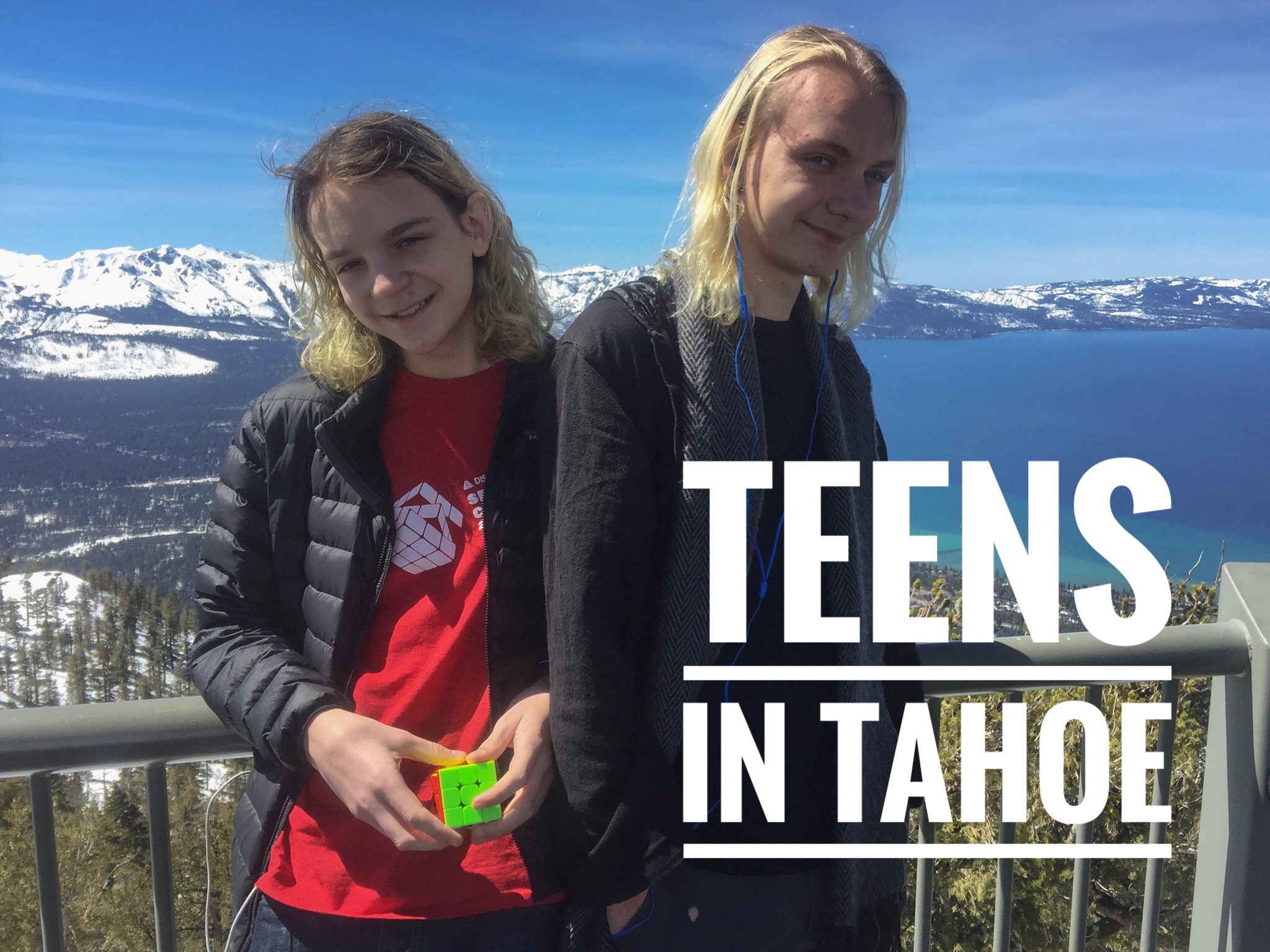
    Another spring break season is rapidly approaching. Last year Fred and George joined me in Nevada for their break and they are heading back here again this year. They once traveled with me everywhere but now we have punctuated adventures like break weeks. As they approach adulthood, they have their own developing ideas of what is fun so as I explore my new-ish stomping grounds in Nevada, I’m always on the hunt for things that will appeal to them when they’re here.

    For their trip last year, my goal was to wow them with the wonders of Lake Tahoe. So after a couple of days at home to recover from the three-hour time change, we set off to a rental condo in Zephyr Cove. I knew they didn’t want their days completely filled. That’s not their style and it’s not mine either. With only a few days at the lake and plenty of downtime built in to play games, explore the beach, and hang out, we had to pick outings that had a lot of value for the time invested. But what to do with kids who aren’t interested in snow sports during the ski season at Tahoe?

    Heavenly Gondola

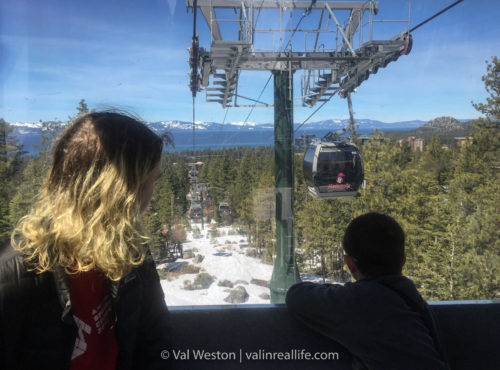
    To get the full effect of Lake Tahoe’s grandeur, we picked a ride on the Heavenly Gondola. While most popular with skiers headed up the slopes, the view is spectacular for any visitor. It is a bit pricey if you’re not going to ski or enjoy a hiking trail. If you go, plan to make the most of your ticket price by exploring a bit, preferably at a leisurely pace. Be sure to stop at the mid-station observation deck where you can get shore-to-shore views of Lake Tahoe as well as the surrounding areas. If you’re not planning to invest any more vacation funds in other activities at the top—like skiing or zip-lining—the view from observation deck is the biggest draw for the gondola ride aside from the lovely ride itself.

    heavenly gondola - val in real life
    The Heavenly gondola ride can impress even the most aloof of teens.

    The M.S. Dixie II

    The M.S. Dixie II is a paddle-wheel boat that runs out of Zephyr Cove and cruises across the lake to Emerald Bay in California. We opted for the daytime cruise which is a stunning 2-1/2 hour ride with a well-crafted narrative about the lake and its history. The recording is broken up into consumable chunks which are best heard on the deck in the brisk spring air. The confined chatter of other passengers made it difficult to hear when inside having lunch.

    As for lunch, food and beverages are available on the boat. The food was passable but pricey. It was a necessity under the circumstances and the timing of our trip, though. Food options aside, the ride is very worthwhile. Think of it as the opposite of the gondola—instead of viewing the lake from above, on the boat ride you are traveling on the surface of Lake Tahoe, getting to know it on a more intimate level.

    emerald bay lake tahoe - val in real life
    Cruising through Emerald Bay on the M.S. Dixie II. (Available on Photoshelter)

    Sand Harbor

    We made a casual visit to Sand Harbor State Park with no big agenda other than to show Fred and George a different area of Lake Tahoe than we’d seen up to that point. Being there in spring, it was still quite chilly and we encountered only a handful of other visitors. That allowed us to enjoy the interpretive trail, geocaches, and Pokémon Go offerings without struggling through crowds that are unavoidable during the summer months.

    sand harbor - val in real life
    Sand Harbor State Park is a favorite lake Tahoe getaway. (Available on Photoshelter)

    Casual exploring

    We didn’t want to be run ragged in the course of exploring activities at the lake so we built in down time to enjoy the property of the condo we stayed in. The attractions are fun but in the end, free-form exploring will always be my favorite.

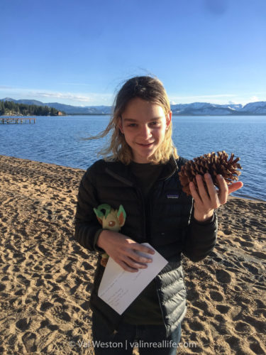
    lake tahoe - val in real life
    George was amazed by the size of the pine cones. They grow quite a bit bigger here than in his Georgia stomping grounds.

    So with that, here’s a short video slideshow of our 2017 spring break at Lake Tahoe, complete with teenage silliness and time lapses.

    Adventure on, friends!

  • A Motorcycle Coddiwomple in California

    A Motorcycle Coddiwomple in California

    It’s January in the high desert of Nevada. I look at the forecast in disbelief finding early spring conditions, not the doldrums typical for the dead of winter. The weather offers a travel window. Five days between mild fronts. Yes, that’s enough time for a short trip.

    But what to do?

    Decision Point

    Keep in mind the weather was much less cold than usual but not what I would call warm. High mountain passes would still be chilly but they would be mostly dry. They are normally covered in snow and ice. Even cleared roads present hazards to riders: icy patches in shadowy corners, road salt and gravel across the pavement.

    After whittling down the options to the best scenario for the conditions and timing, I decided to head for the California coast. Getting over the Sierra Nevada would be manageable if I stuck to I-80. Typically in January, the mountains would be an impenetrable wall to a motorcyclist, denying us access to warmer riding weather to the west. While interstate riding isn’t ideal, it would serve my purposes for this trip.

    What comes after that? Truthfully I made the deliberate decision not to have a plan. Armed with a Butler motorcycling map of northern California (Amazon affiliate link) and a seed planted by a Facebook meme, my goal for this trip was simple. A coddiwomple, by motorcycle.

    A Minor Complication

    As I mentioned, the weather was warm for the season but not actually, measureably, warm. And my four-season motorcycling pants were off on their own month-long adventure for a warranty repair. That left me with only my mesh summer pants. Even with the insulating liner in, they weren’t going to cut it for this trip.

    Then the good news came! My repaired pants were scheduled to return to me on the eve of my trip. Yes! I did a happy dance.

    Then the dreaded delivery update came. Weather delays on the route meant the pants wouldn’t arrive until after I had to leave. Argh!

    That presented another problem though. My not-inexpensive motorcycle pants would be sitting on my front porch for five days in my absence. In a world where stealing packages off of front porches appears to be the crime du jour, that wasn’t an appealing scenario.

    It became clear I would not have the pants before I absolutely had to be on the road. I had to do damage control before I left. Hours of phone calls and internet inquiries consumed my time as I tried to get the delivery delayed until after my return.

    The powers that be were having none of that, though. It came down to leaving a note for the delivery man who I hoped would graciously hide the package in an obscure place for me. He did. I haven’t seen him since but I hope he doesn’t mind a big thank-you hug when I do.

    Gear alternatives

    So what came of the pants dilemma? My summer pants just wouldn’t do the trick as much as I tried to hack my situation. In the end I wore my dear man’s old motorcycle pants. I’m all for choosing men’s gear when it’s a better choice (boots, gloves, and the like) but pants are a different story.

    In the end, they did the trick but I spent the entire trip hiking the pants up and repositioning the armor every time I got on and off the bike. The too-large and too-long pants were not a pretty sight — so no, I’m not going to share a picture of that hot mess. 😉

    motorcycling donner summit in winter - val in real life
    It may not look like a weather window to most, but this proved to be a rare opportunity to cross the Sierra in winter on motorcycles.

    Coddiwompling

    Getting over the Sierra

    My delayed exit on the first morning meant only making it to Vacaville, California. We peeled off of I-80 at Davis, to relieve the pressure of interstate riding. It can be efficient, and in some cases, safer for riders but it’s usually not fun riding. And other than needing to get over the Sierra, riding the interstate is decidedly un-coddiwomply. We wiggled through the backroads to enter Vacaville from the north. Along the way we were treated to delightful rolling hillsides dotted with cows grazing peacefully.

    motorcycle coddiwomple on highway 12 in california - val in real life
    Rolling hills of farmland had me humming “Sound of Music” tunes as I rode.

    Motorcycling our coddiwomple groove

    On the following day we began the coddiwomple in earnest. We rolled out of Vacaville the way we had come in to meet back with Highway 128 and ride the twisties westward to the coast. Much of that route hugs lakes and creeks with cozy little wayside parks to stretch your legs. A lunch stop in charming Calistoga allowed us to contemplate some of the sights we’d taken in along the way—stunning beauty juxtaposed against the scars of the recent and devastating wildfires there.

    Post-lunch wanderings led us southward to merge with Highway 12 for a bit before peeling off north again along Bohemian Highway—a surreal, rainforest-like tunnel of dampness in some stretches that took us through Occidental, a little tourist town. The fairly slow but scenic route often involved navigating shitty pavement but it dumped us out onto Highway 116 to ride westward along the Russian River.

    A slight detour

    A slight navigational error with me as the lead rider—or what I like to call a happy accident—led us to riding north along the coast through Jenner on Highway 1, mouths agape at the view. The Russian River dumps out into the ocean and you cruise along the coast, Highway 1 perched on a cliff, the ocean pounding the shoreline below. For a Florida native, it’s otherworldly to see the ocean this way. Fatigue was beginning to get the better of me so my adventure partner took the lead after an overlook break to enjoy the scenery near Palisades Point.

    We continued south on Highway 1 to Bodega Bay, basking in the glory of the coastal ride until we needed to turn back inland towards Sebastopol for an affordable room for the night. That resulted in another happy accident, discovering the joy of Martha’s Old Mexico, a fabulous dinner spot. I’m a sucker for chili verde and theirs is practically orgasmic. I ate way more than I should have before waddling my overstuffed body back to the hotel to soak my stiff, aching Frankenleg in the hotel hot tub and enjoy a nightcap, having replenished my evening whiskey stash on the walk back to the room.

    street view of my f700gs in calistoga california - motorcycle coddiwomple - val in real life
    Lunch break in the charming town of Calistoga.
    motorcycling highway 1 on the california coast - val in real life
    The blustery and beautiful California coast is a far cry from the Florida coastline I grew up with.

    Managing fog

    Day 3 began with thick fog which delayed our exit. We had late starts on most mornings to manage the reduced visibility created by the fog but this was by far our latest. But catching up on work and life was in order so it fit just fine in the big scheme of the coddiwomple. Once it was clear enough, Highway 12 back to the coast was calling our name. It put us back on Highway 1 south through the rolling countryside to the cliff-gripping highway that would take us to Point Reyes National Seashore.

    After a stop at the visitor center to orient ourselves to the park, we rode to Schooner Bay. The road was closed to general traffic beyond this point. If we wanted to see the lighthouse we would need to wait in line and ride a bus. It was a busy holiday weekend and the crowds were daunting. Our late start that morning meant we were also in jeopardy of not being able to get back inland for a reasonably priced room for the night if we took the time to fully experience the park. We decided against the bus-and-lighthouse-tour. No worries, though. I got a taste and I’ll be sure to allow more time to explore it next time around. It really is stunning.

    Managing fuel

    Leaving the park, we needed to manage our fuel supply so we backtracked just a bit to Point Reyes Station to avoid finding ourselves stranded on the coast which has surprisingly few gas stations. With that sorted, we continued south on Highway 1. That section proved to be as stunning as its northern counterpart. However, it had the added challenges of substantial construction zones and, shall we say, eyebrow-raising wind gusts blasting around the curves of the crenulated coastal road.

    Once the highway turned back eastward through the Muir Woods area. We were relieved of the surprise gusts but hampered by the heavy traffic of the holiday weekend in a sublimely beautiful place. We landed near Sausalito for the night, having intended to be further north by the time we called it quits for the day. But that set us up for another fabulous turn of events. We were very close to one of my dear Hell Hike and Raft sister’s stomping grounds. We got to spend the evening with Annie of Outdoorsy Mama fame. There may have been some overindulging in adult beverages that evening as we caught up.

    point reyes national seashore - california motorcycle coddiwomple -val in real life
    Beautiful Point Reyes National Seashore was bustling on the holiday weekend so we stuck to less-crowded areas to briefly explore the park.
    outdoorsy mama and val - val in real life
    Catching up with Outdoorsy Mama.

    Hanging with locals

    That late-but-welcome celebration meant a slow start the next morning. Our not-very-bright-eyed-and-bushy-tailed selves moved slowly up to the Windsor area along the unexciting Highway 101. The next weather front was beginning to approach more quickly than the forecast indicated before we left so we found ourselves in overcast, damp, chilly weather. A short day was certainly in order as we were working our way to meet up with more friends to explore a bit of the micro-distillery action going on in Sonoma County. We had the privilege of tasting great spirits made by young enthusiasts who are turning their hobby and love of the craft into small businesses. Their energy is inspiring.

    Spending time with people who love where they live is one of my favorite experiences. As our supremely gracious hosts gave us a personal tour of their stomping grounds their love of Sonoma County co-mingled with sadness for the devastation brought by the wildfires last year. Listening to first-hand accounts of what it’s like to prepare to evacuate—the frenzy of what’s happening around you and uncertainty about what to do next—is sobering. The evening was not grim, mind you. But in the midst of celebrating friendship, the poignancy of sharing a difficult experience with us was not lost on me.

    The closing weather window

    The final night of our coddiwomple we needed to prepare and plan just a bit for the return over the Sierra. The weather was beginning to catch us and we had to strategize about our route and timing. We were able to maintain some level of coddiwompling as we worked our way back east. We meandered through back roads to meet up with I-80 which again proved to be our best choice to blast back over the hill.

    sonoma brothers distillery - val in real life
    Brandon of Sonoma Brothers makes a lot of great stuff including a gin that rivals my favorite local one from Frey Ranch.
    barren sycamore trees on a cold winter day in windsor california - val in real life
    Our warm motorcycle coddiwomple turned cold but still better to be riding than not!

    Maximizing the final day

    A slightly different path east than we came west on Day 2 took us through the Napa area and north on Highway 121, a short-but-fabulous ribbon of twisties that rides like an elegant waltz. It was a soothing respite before the business-like ride that lay ahead on the interstate.

    We rolled into home as the sun set and the chill of the weather began to sink into our fatigued bodies. After a quick round of drive chain maintenance to combat the winter road muck we tucked our bikes away into the garage, not knowing when we might be able to ride again. After shedding motorcycle gear, I went to check on my errant delivery. Sure enough, the box was waiting for me in the designated spot. I silently thanked our delivery man for being so agreeable and went inside to assess the repair to my pants. Seeing they were as good as new, I hugged them, having missed them so. My pants in one hand, I not-at-all-sadly relinquished my loaner pants to their owner with the other. Next time I coddiwomple, it will be in motorcycle pants that fit. 😉

    What does a motorcycle coddiwomple look like?

    Apparently this! In the end the trip was about 900 miles over the five days—a very leisurely pace. The bulk of the mileage was obviously on the first and last days but you can use the interactive map below to zoom in on the wigglier bits to get a sense of the meandering nature of the trip. I will say for my non-riding friends out there, you don’t need to be on two wheels to enjoy this area—it’s a fabulous trip no matter what transportation you choose.

    Cheers, friends. Adventure on!

    motorcycling the california coast on highway 1 - val in real life
    Every turn along Highway 1 provides breath-taking scenery. It’s an extraordinary ride.
  • Itching for a Big Adventure

    Itching for a Big Adventure

    My travel life has changed dramatically in the last couple of years. Not better or worse; just different. My time is broken into smaller blocks so I’ve been piecing together shorter adventures rather than spending weeks on the road like in the past. On the one hand that’s simply the nature of my life at the moment. On the other, do I accept that fate? Or do I go full Val on this and orchestrate something within this context? A trip that serves all of the facets of my life at the moment instead of being constrained by them.

    Make no mistake, I love all of my adventures, short or long. All of them have been fulfilling and worthwhile. Lately, though, they’ve been exclusively short. So I’m itching for a big adventure. One with an open-ended finale. One that takes weeks or months. Those trips have a different rhythm and context. They are their own distinct, wonderful beasts. And the construct on my life as it is now looks nothing like the last time I took and extended trip so I don’t have an established game plan like I used to. I have to build the framework for this from scratch.

    This isn’t an easy task. But is it possible? Yes. It will take a lot of effort though. And that’s what gets us, isn’t it? When we can’t reconcile the effort involved with the return on investment, so it doesn’t happen. But for me, this is what makes life worth living. Exploring. So going to great lengths to make this a reality is well worth the effort.

    dog in sidecar - val in real life
    The adventure dog presents extended travel challenges but this is what Betty was made for.

    What might it look like this time around?

    In the infant stages of considering this, it will almost certainly involve Big Betty Blue. First because I by far prefer motorcycle travel. Second because managing the adventure dog is one of the biggest hurdles to being gone for an extended time. That’s a large part of the reason for buying Betty in the first place. Dog sitters add a lot to the cost of travel as well as time constraints based upon dog-sitter availability. If he’s with me, I can be more flexible.

    But I’m not even remotely dialed in on traveling with him in the rig yet. There’s a big learning curve to keep everyone happy and safe. Going that route will mean starting with micro adventures to refine the process.

    If I toss Betty in the toy hauler, then it’s an RV trip with mini motorcycling side trips, a process I also have yet to refine. That’s a very different adventure with both upsides and downsides over pure moto travel.

    Either way this is slow, immersive travel. Both vehicle scenarios involve rigs that don’t get anywhere quickly. But that’s ok. Slow travel is what I like most and has been a footnote in my adventures the last few years.

    grey wolf rig - val in real life
    Is putting Betty in the big rig the answer to my wanderlust?

    Priorities

    Thank you for joining me for this little “thinking out loud” exercise. I get a lot of questions about how to pull these things off. The lesson for the uninitiated is that big adventures don’t just fall into place. They require orchestration, especially when juggling family and pets. In my case that includes family on opposite sides of the country! As I ponder this year’s calendar, I’m not even remotely certain if I can make this happen in 2018 but I want to badly so I’m working to make it happen.

    In the end, it’s a matter of priorities. My top priority is exploring.

    Exactly how and when I will scratch this itch remains to be seen. Stay tuned.

  • A Beginner’s Guide to Death Valley

    A Beginner’s Guide to Death Valley

    In recent years, I’ve had the good fortune to explore Death Valley National Park in a variety of ways: by camping and hiking, motorcycle travel, family travel, a photography workshop, and 4×4 excursions. Through those adventures, I’ve become a huge fan of the park. That means I often get quite enthusiastic about extolling the virtues of what it has to offer visitors.

    So today I’m bringing you a beginner’s guide to Death Valley. Hopefully this basic introduction will give you the important details you need to make the most of your first trip to the park. Be sure to check out the full photo galleries at the end of the post for more images.

    Background

    • Death Valley is the largest national park in the lower 48 states. At over 3.3 million acres, it’s almost as big as the state of Connecticut. Even at its narrowest width, it can take two hours to drive across it.
    • It was designated a national monument in 1933. In 1984, the boundaries were expanded and it became a national park.
    • In spite of its foreboding name, it is rich with history and natural diversity.
    • The park hosts about 1.3 million visitors a year.
    • Activities for visitors in the park include hiking, camping, sight-seeing, bicycling, birding, and backcountry driving.
    mesquite sand dunes - val in real life
    Come see why so many visitors are captivated by Death Valley.

    Before you go

    • Visit the park website. It is the ultimate clearinghouse of introductory information as well as the constantly changing details about road conditions, campgrounds, and points of interest.
    • Understand that there is very little cell service in the park so you can’t rely on your phone for emergencies or even basic communication in the vast majority of the park.
    • There are wide seasonal variations in temperatures and weather. The time of year you visit will dictate how you need to prepare for outdoor activities.
    • The wildflower bloom season in February is very popular. A trip at that time of year often requires lodging reservations months in advance.
    • If you’re coming for dark skies, pay attention to the moon. It may seem obvious, but rangers often encounter visitors who come for the park’s dark sky status but haven’t figured on a full moon. While any nighttime experience in Death Valley is spectacular, pay attention to your timing if your focus is dark skies.
    • Follow the park’s Facebook page. It is active and extremely informative.
    death valley super bloom - val in real life
    Wildflower season (typically in late February) is a popular time to visit the park.

    When you get there

    • The visitor center is always the best place to start your adventure in any national park but particularly in Death Valley. The park rangers can help you decide the best way to spend your time at the park, what programs will be offered while you’re there, and give you the latest information on road and trail conditions.
    • Pick up the park’s Visitor Guide newspaper. It is chock full of the most important information all visitors need to know about the park. You can pick one up at the park entrances, hotels, restaurants, or the visitor center. It’s even available online if you want a head start.
    • Once you decide on some activities, pick up a tip sheet for your selections. The park offers individual one-page guides for almost every trail and site. You can find them at the ranger desk in the visitor center.
    death valley guides - val in real life
    Materials at the visitor center will help you make the most of your Death Valley experience.

    Rules

    • Pay the fee. There are kiosks that accept credit cards at the major entrances or you can pay at the visitor center. Many visitors don’t realize there is an entrance fee to visit the park.
    • Dogs must be on leash at all times. They are permitted along roads, in campgrounds and picnic areas, as well as select developed locations. But there are vast limitations on where you can go with your pet. They’re not permitted on trails, in the open desert, or inside most buildings and they cannot be left unattended in a vehicle. Please choose wisely when considering bringing your pet to Death Valley.
    • You must stay on roads when traveling in a vehicle. But you can hike anywhere; trails are not the limiting factor in Death Valley.
    • Collecting anything in the park is prohibited—rocks, plants, animals, and artifacts are all protected. If you’d like a memento of your visit buy a souvenir from the visitor center. That helps support the park and preserves the landscape for future visitors.
    • Vandalism is a growing problem in all parks and Death Valley has had some high-profile, extremely damaging events in recent years. I know you aren’t planning to drive your car onto the Racetrack Playa like a recent visitor did, but please keep in mind that even building cairns—though it may seem harmless—is considered vandalism. Simply leave the landscape as you found it and future visitors will get to have the rich experience you’ve had.
    father crowley point - val in real life
    Dogs are welcome along roadways and must be on a leash at all times.

    Safety

    • Water! Dehydration is one of the most serious considerations in Death Valley. Most visitors need more water than they realize. The park experiences more rescue incidents when temperatures are over 100 degrees (F) because it doesn’t feel that hot due to the low humidity. In extreme heat, it’s also crucial to manage your electrolyte levels since your body is losing these, too. Without adequate electrolyte balance, you can still have a critical situation even if you have enough water.
    • In Death Valley a GPS receiver can be misleading at best. Satellite navigation devices often lead visitors to roads their vehicles can’t handle or that don’t exist at all. Pick up a physical, printed park map and orient yourself to the major roads and facilities. Your life could depend on it. The map from the park service is helpful if you’re sticking to the main, paved roads but I highly recommend the National Geographic Death Valley map from Trails Illustrated (Amazon affiliate link).
    • Road conditions change constantly in Death Valley, especially on the vast network of dirt roads. Many of the roads that are usually accessible to an average sedan can sometimes be treacherous depending on recent weather conditions. That’s why it’s important to learn about conditions while you’re there. There are also roads in Death Valley that are only accessible by high-clearance or 4×4 vehicles even at the best of times. It’s important to know which roads are appropriate for your vehicle.
    death valley - val in real life
    Check with park rangers to make sure your vehicle is up to the task on Death Valley’s dirt roads.

    Food, Lodging, and Supplies

    • The three lodging and supply centers within the park are The Oasis at Death Valley (formerly called Furnace Creek), Stovepipe Wells, and Panamint Springs. These privately operated facilities offer hotel rooms, cabins, tent cabins, and campsites for RVs and tents. 
    • There are many camping options within the park, both developed and in the backcountry. Some require reservations but many are first come, first served.
    • Given the location and size of the park things like fuel, food, and supply choices are limited. That also means the prices are higher than many visitors anticipate and it catches them off guard. Visitors simply need to understand it takes more effort to get supplies to the park. It’s extremely isolated. That raises prices.
    stovepipe wells general store - val in real life
    Stovepipe Wells is one of three lodging and supply locations inside the park.

    My recommendations for activities

    For a park the size of Death Valley, the seasonal variations, and the variety of activities you can choose from, it’s nearly impossible to give a definitive recommendation on what to do. Your timing, inclination for adventure, and current park conditions will determine your best choices while you’re there.

    However, for a first-timer, you can’t go wrong with some of these tried and true favorites to initiate yourself to the wonders of Death Valley.

    junior ranger program - val in real life
    Get the whole family involved by participating in the Junior Ranger program.
    • Spend the night in the park. It may be tempting to come in for just a day. But Death Valley is just as spectacular at night as it is in daylight. And in a very different way. Take the opportunity to soak it in and know that one day barely scratches the surface here.
    • Artist’s Drive: It’s like a roller coaster for vehicles, with glorious geologic scenery.
    • Zabriskie Point: Accessible to even the most casual of visitors but a stark and extraordinary landscape.
    • Badwater Basin: At 282 feet below sea level, the salt formations are entrancing.
    Badwater Basin - val in real life
    The salt flats of Badwater Basin occasionally flood but you’ll typically find it dry.
    • Dante’s View: Remarkable vista over Badwater Basin. The view is incomparable.
    • Mesquite Sand Dunes: Sunrise and sunset here are captivating. The way the light plays on the sand, ripples, and dunes is magical.
    • Rhyolite Ghost Town: Just outside Death Valley, this ghost town is home to a historic train depot and quirky art. Take your camera and have fun! The sights are truly bizarre and fabulous.
    • Mosaic Canyon is an easy, accessible hike near Stovepipe Wells that gives you an up-close look at the intricacies of the geology of Death Valley.
    • Titus Canyon: If you have a high-clearance vehicle or decide to rent one at the park, this drive is extraordinary and well worth the few hours it will take you. The geology, history, and vistas are amazing.
    • The Racetrack: The famous Racetrack Playa is a huge draw for visitors to Death Valley. Walking amongst the mysterious “floating” rocks is a delight but is only appropriate in dry conditions. Don’t walk on the playa if it is wet or muddy. Getting to the playa involves rugged driving, therefore a high-clearance vehicle is recommended. Check with rangers at the visitor center for advice on whether or not your vehicle is suitable for the current road conditions when you visit.
    the racetrack death valley - val in real life
    The “floating” rocks of the Racetrack Playa

    Enjoy your visit!

    Of course, this is just enough to get you started at Death Valley National Park. There’s so much more you can dive into if you have the time to go deeper. But that’s a post for another time.

    And like any outdoor adventure, visitors need to approach the park with curiosity as well as caution. For all of its extraordinary beauty and the accessibility provided by the National Park Service, Death Valley is still a wilderness. Armed with the information here and on the park’s website, you’re on your way to having a fantastic experience.

    I have to send out extreme appreciation and thanks to the the fabulous Ms. Abby Wines, National Park Service Management Assistant for Death Valley, for sharing her knowledge about the park with me to help make this guide as comprehensive as possible. Thank you, Abby!

    Activities

    Recommended sights

    Food and lodging

  • Eight Years of Geocaching

    Eight Years of Geocaching

    I began geocaching on my birthday in 2009. That means in a few short weeks, I’ll celebrate eight years of geocaching. I need to confess, however, that I’m not a rabid geocacher. I go through ups and downs with being engaged. In spite of those waves, I’ve always enjoyed the unexpected places geocaching takes me, the people I meet, and what I discover in the process.

    stone mountain geocache - val in real life
    My very first geocache, an easy find at Stone Mountain Park in Georgia—using paper no less, since I didn’t have a GPS yet.

    Taking on a challenge

    Beyond the intangible aspects of the sport, geocaching is also a numbers game. It comes with a lot of statistics you can obsess about—how many caches you’ve found, when you’ve found them, where you’ve found them, the types, the difficulty, how many miles your trackables have logged, your streaks, your find rate, your best month, best year, etc. There are a lot of different ways to track your geocaching numbers. Which means there are a variety of ways to challenge yourself in geocaching. You can fill the calendar grid, fill the difficulty/terrain grid, get caches in all states/provinces/countries, complete power trails, clear various radius distances from home, complete local municipal challenges, find a cache in all counties in a state, get all the different types of caches—the list goes on and on.

    As my eighth anniversary approached, I was mulling over my calendar statistics—the grid that shows what days of the year I’ve logged geocache finds. I was pleasantly surprised to see that I was only about 60 finds away from completing my calendar. And thus, a personal challenge was born. 

    But what’s an adventurer to do when she wants to take on a challenge but isn’t certain she can deliver on it with other demands in life her at the moment? Well, in my case, I didn’t make a big announcement about what I was trying to accomplish! That way if I didn’t make it, no one would be the wiser, right?

    So I quietly pecked away at my needed dates. There were many times I thought I wouldn’t make make it and several times I nearly didn’t. The logistics of grabbing smilies during hectic travels, including being in Atlanta for Dragon Con, proved supremely challenging on some days. Even from home, sometimes a simple smiley turned into an adventure getting a stalled sidecar rig back home. And sometimes getting out to grab a geocache was a forgotten task in the midst of work and life. That is, until I’d have an “Oh shit” moment late in the day and race out. One of the saving graces in my quest is that my Nevada HQ has a power trail that runs, quite literally, right behind it. Sure, they’re easy and often not terribly interesting, but in this context, they were my best geocaching friends the past few months.

    Finally, with a decided lack of fanfare, I filled in my last date in October. On a busy day, it didn’t feel that epic. Looking back at my full grid now though, I get a big smile on my face and a sense of satisfaction. Especially knowing it didn’t come easy but it did come with lots of fond memories of the adventures I had in achieving the goal. From the daunting efforts to the silly ones and everything in between, they’ve all been worth it. Filling the calendar felt contrived at times but it did motivate me to get out and explore, even in micro-increments. And in the course of filling the grid, I did find discover cool places, as is almost always the case in this sport.

    geocaching calendar - val in real life
    It’s so very pretty when it’s all filled in! I don’t know that I can articulate the depth of what this represents in terms of my adventures in the last eight years.
    geocaching atlanta - val in real life
    One of the challenges in filling my calendar? Being in Atlanta during Dragon Con. Kind of hard to get to the geocache when muggles are doing a photo shoot on top of the container.
    sidecar geocaching - val in real life
    Geocaching by sidecar with a large dog can be a challenge when your rig stalls and you can’t get it restarted. A quick, easy smiley turned into a not-so-quick one. That’s where the adventure lies though, never knowing what’s ahead.

    Memory lane

    As I was reviewing images for this post, sifting back through eight years of geocaching adventures left me slightly speechless. Processing everything geocaching has brought to my life in one fell swoop and realizing how much ground I’ve covered in pursuit of geocaches is kind of amazing. In the course of all of this, I’ve gotten geocaches in all of the lower 48 states, nine Canadian provinces, and one little smiley in Baja.

    My oldest trackable that visits all my finds, has logged almost 75,000 miles. My best streak (finding a geocache on consecutive days) is 170 days, spurred on by George’s desire to see how long we could go. Sadly, my streak without a geocache is almost as long at 158 days. Oopsie. There’s that lack of engagement rearing its head.

    Oftentimes my geocaching efforts involved dragging Fred and George on weeks-long road trips across North America. We’ve done CITO (Cache In Trash Out) events, geocached the E.T. Highway, attended Geowoodstock 10, multiple Going Caching events, and completed the Georgia State Parks Challenge, among many other accomplishments.

    Much of the time these days, I go solo. There are times though that I ask patient friends to wait while I “just grab a quick smiley” which is not always as quick as I plan. (Thanks for bearing with me, peeps!) I go by car, foot, motorcycle, and sidecar. Regardless of the context, geocaching has taken me to a lot of places I wouldn’t have otherwise visited. And it has added depth to places I already planned to be, particularly when you consider earthcaches and historic site geocaches.

    cito in atlanta - val in real life
    Geocaching has helped us get involved in community clean-ups, know as CITO events.
    geocaching education - val in real life
    Many of our geocaches were tied to experiential education for Fred and George. We learned a lot by including geocaching in our homeschooling!

    The Nevada irony

    Most of the time, geocachers have the most finds in their home state. Makes sense, right? Closer to home is where we usually have the most frequent and accessible opportunities. When I started geocaching, that meant Georgia for me. But completing the E.T. Highway power trail in 2012 threw my statistics out of whack. Because of the nature of power trails, you amass big numbers quickly. In my case, the E.T. Highway made Nevada the dominant state on my geocache map even though in reality I lived on the other side of the country. That always struck me as amusing until it became ironic when I ended up moving to Nevada last year, something I would have never predicted back in 2012. That’s one way to put your map back in sync, I suppose.

    geocaching map - Val in real life
    My map was skewed to Nevada for several years until I ended up moving here.
    Geocaching e.t. highway - val in real life
    I didn’t know when we did the E.T. Highway in 2012 that I’d eventually call Nevada my home state.

    The next challenge?

    With my renewed enthusiasm for giving myself geocaching challenges, my next efforts will be to use geocaching to become intensely familiar with my new stomping grounds near Carson City by clearing an increasing radius. In tandem, the next obvious challenge to tackle is my difficulty/terrain grid. It’s heavily skewed towards easier finds because of power trail finds. I’d like to expand my geocaching cred by diving into the more difficult geocaches. This sport takes you unexpected places and I know I will discover amazing things by pursuing harder-earned smilies.

    It’s been a fabulous eight years of geocaching. I don’t know exactly where the next eight will take me but I do know it will be memorable.

    geocaching grid - val in real life
    Clearly I have some work ahead of me to get my D/T grid filled!

    See you on the hunt, friends! Here are a few more random memories from the geocaching archives.